
Waves from the Pacific Ocean slam against jagged mountains. The California coast is one of Earth’s most beautiful and imposing places. The Pacific Coast Highway is the most significant route to view the California coast. Along the California coast, it begins in Mendocino County, north of San Francisco, and travels 656 miles south to San Juan Capistrano, south of Los Angeles. The Pacific Coast Highway’s path from San Francisco to Big Sur is among its most picturesque. Along with advice on having the most enjoyable, beautiful drive possible, this guide lists all the must-see locations along this coastline scenic drive.
Let’s get started and organize your Pacific Coast Highway driving vacation!
Broad Information About Pacific Coast Highway Scenic Drives
Warm weather is a hallmark of California throughout the year, especially in the coastal areas. The Pacific Coast Highway is open year-round as winter approaches and experiences pleasant weather.
The summer is the busiest season on the Pacific Coast Highway, even though the weather is stable throughout the year. Try going between November and March, the off-seasons, to avoid the crowds.
It takes four hours to travel nonstop from San Francisco to Big Sur. This trip is best done over several days, while it may involve finishing in a single day. Stay the night at Pacific Grove or Monterey. After touring Big Sur the following day, you can continue your journey to Los Angeles or return to San Francisco by car.
Crucial Advice for Traveling by Car from San Francisco to Big Sur
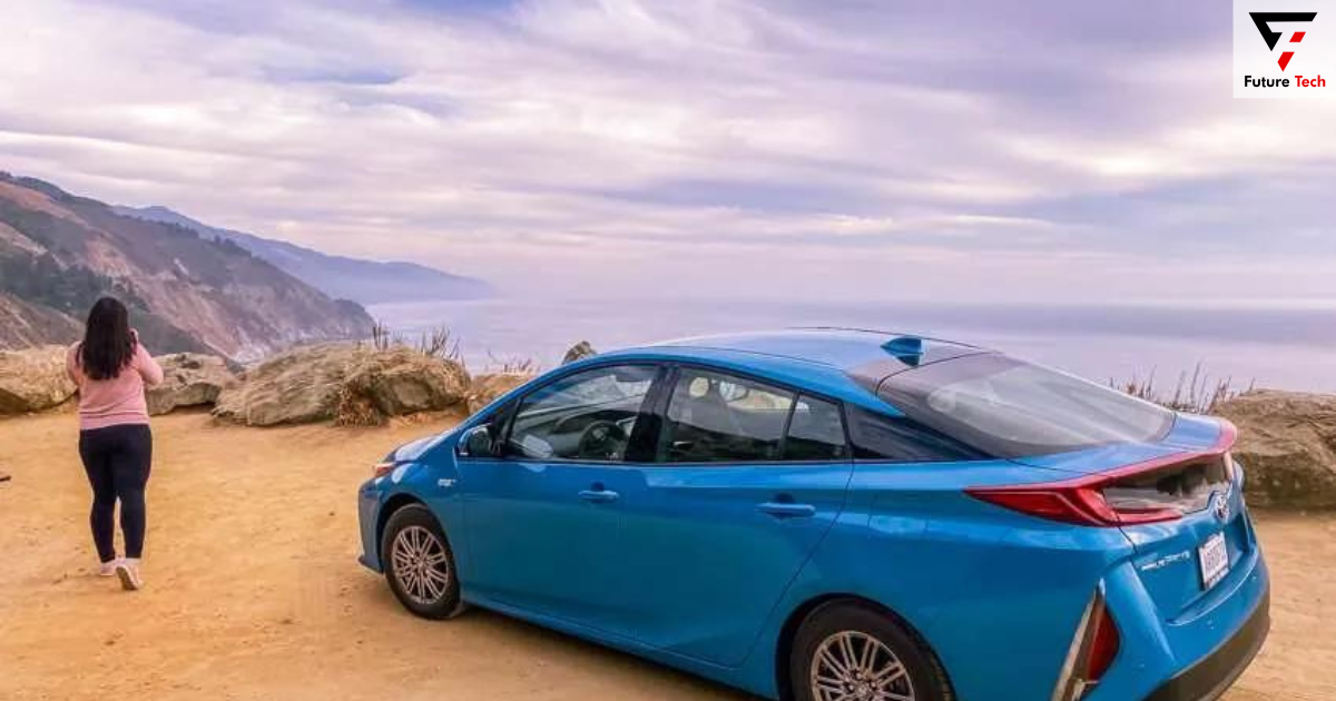
Travel southward from San Francisco to Big Sur. You can see the ocean without obstructions when traveling north to south along the Pacific Coast Highway. Additionally, when driving south, the pull-offs remain to your right. The driver is safer by doing this instead of cutting across oncoming traffic.
Take it gradually and drive carefully. There are a lot of breathtaking views along this highway, and you will want to experience everything. Don’t make specific plans at the end of your drive, such as reservations for dinner. It would help to pause at every viewpoint to enjoy the sharp cliff edges and salty ocean breeze.
Because parts of the Pacific Coast Highway are remote, there’s a good chance you’ll lose mobile coverage. Before you go, print off or take a screenshot of your map and sites of interest. Get Google Maps for travel assistance.
Stow a portable power supply. It would help if you packed a car phone charger because you’ll be using your phone for navigation, taking pictures, and recording points of interest.
The Pacific Coast Highway’s most isolated section is unquestionably Big Sur. In the hamlet of Big Sur are the only petrol stations within a fifty-mile span in the wilderness. Before you leave Carmel-by-the-Sea, make sure your petrol tank is full.
Nights in Northern California are cold, while days are warm. Bring a warm jacket if you plan to drive at night or stop for the sunset because it can go as low as the 40s.
Are you seeking additional advice on what to bring for a road trip? For all my finest gear recommendations and packing advice, check out my guides on the ideal road trip packing list and the most excellent road trip planning tools! They will help you prepare for your trip with ease!
The Top Pacific Coast Highway Stops between Big Sur and San Francisco
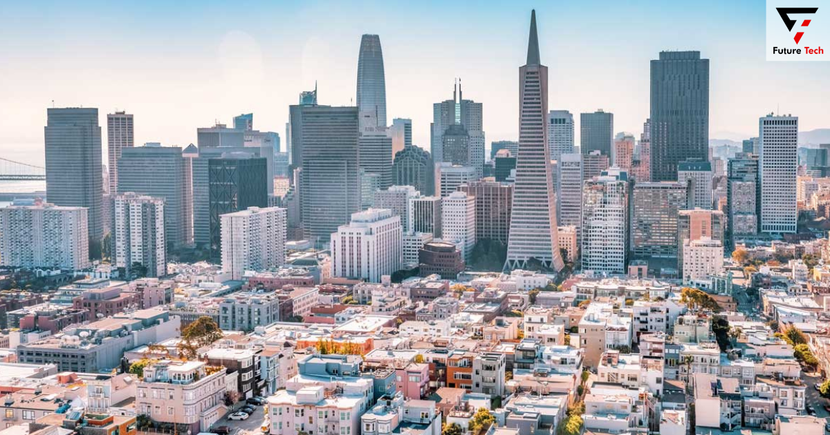
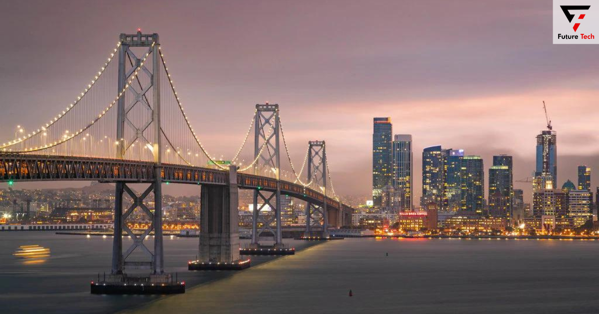
1. The Bay Area
San Francisco is directly in the path of the Pacific Coast Highway—Asian and several Hispanic influences in the cultural melting pot that is the City by the Bay.
After crossing the Golden Gate Bridge, have a famous Mission burrito or visit Chinatown for some dim food.
Make the journey to Twin Peaks if you want a broad perspective of the City on a clear day.
2. The Devil’s Stem
You’ll pass through a tunnel after Pacifica, a seaside town. Before the tunnel’s 2013 opening, drivers had to negotiate the treacherous Devil’s Slide, which was prone to rockslides.
Today, cyclists and hikers are welcome to use this treacherous stretch of the route. Take a break and extend your legs on Devil’s Slide.
3. Bay of Half Moon
Surfers and visitors alike love this coastal town. The cliffside Ritz Carlton Half Moon Bay is a great lunchtime location for high rollers. Stop for petrol and refreshments before continuing down the rocky shore.
4. Lighthouse at Pigeon Point
About 20 miles south of Half Moon Bay is one of the West Coast’s tallest and most photographed lighthouses. This still-functioning lighthouse’s tourist center displays the original Fresnel lens.
You might be fortunate enough to see seals or whales in the water below.
Something unique about this lighthouse? On the premises is a hostel with a hot tub perched on a cliff for visitors.
5. State Park of Año Nuevo
Its main draw is the three to four-mile hike to see elephant seals in Ano Nuevo State Park. During the mating season, guests can reserve a guided tour on reservecalifornia.com from December to March.
Before beginning the trek, visitors must get a permit from the state park service for the remainder of the year. In California, state parks require an admission charge of $10 per vehicle.
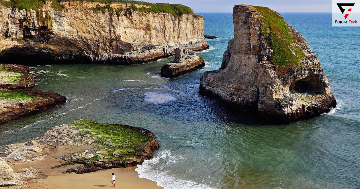
6. Cove of Shark Fin
This vista gets its name from a remarkable rock structure resembling a shark fin poking out of the water. To get a bird’s-eye perspective of the cove, park your car there and walk across the railroad tracks. I am strolling on the cove’s southern edge to see the ocean. This location is lovely around dusk.
7. Park at Natural Bridges State
A natural bridge is an arch that forms naturally and needs water to pass over it. These seaside bridges are incredibly well-liked at dusk.
You can park and view the natural bridges from the state beach for the $10 park admission charge.
8. The Santa Cruz
This surf town’s historic boardwalk is the most visited location. 1904, a boardwalk is made atop the remnants of former seaside bathhouses. Play games at the amusement park or ride the 1924 wooden roller coaster now. Park at Santa Cruz Wharf and stroll down Beach Street to get to the boardwalk.
A great summer day will find Santa Cruz packed, so be prepared. Anticipate significant traffic jams.
9. Pezzini Farms
One of the state’s primary agricultural regions is the area between Santa Cruz and Monterey. Along the Pacific Coast Highway in this area are numerous produce stands along the side of the road.
Most of the country’s artichokes and Brussels sprouts are grown on these farms.
Visit the venerable Pezzini Farms outpost in Castroville to purchase entire artichokes or a fresh supply!
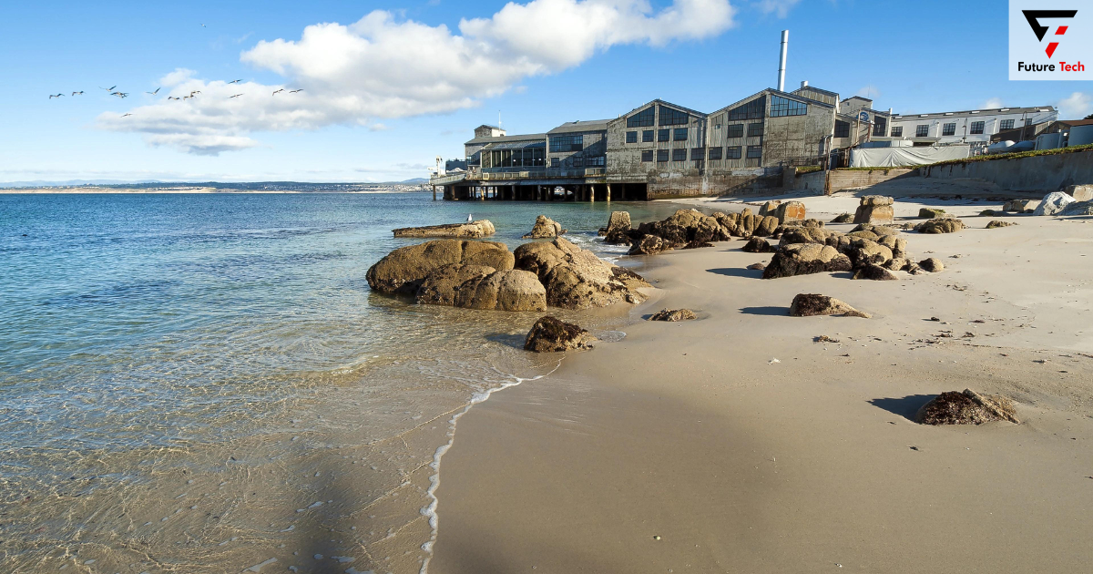
10. Monterey
An old cannery town, Monterey is home to one of the most well-known aquariums in the nation.
Travel to Lover’s Point Park by strolling along the Monterey Bay Coastal Trail. In Pacific Grove, get a bite to eat along Lighthouse Avenue. If you plan a road trip to Big Sur, this is the ideal halfway place to spend the night.
11. The 17-Mile Road
This picturesque drive, which passes by the well-known Pebble Beach golf course, welcomes 1.5 million tourists annually. Pause to see the renowned Lone Cypress, which is nearly 250 years old. 17 Mile Drive has many entrances. Starting at the Pacific Grove entrance and ending at the Carmel gate is how I like to do it.
The gate sits at the intersection of Sunset Drive and 17 Mile Drive. You will receive a road trip map to help you navigate the picturesque drive after paying the $10.50 per vehicle admission fee.
12. Carmel-by-the-Sea
This affluent seaside town may have magnificent and opulent coastal villas. Drive along the seaside Scenic Road and marvel at the million-dollar homes to see how the 1% live.
Ocean Avenue, Carmel’s main thoroughfare, is lined with quaint eateries and coffee shops where you may stop for a bite before making your way to Big Sur. Make sure you have a full tank of gas before you leave Carmel-by-the-Sea.
13. Lily Valley of Calla
It is impossible to miss Calla Lily Valley if you are visiting in the spring. During the flowering season, calla lilies blanket this bluff overlooking the ocean.
Pause in the dirt pullout right before the Garrapata State Beach parking lot. To see the wildflowers up close, take a stroll down the bluff.
14. Bridge across Bixby Creek
The Bixby Creek Bridge, arguably the most famous section of the Pacific Coast Highway, has been highlighted in television series such as Big Little Lies. Completed in 1932, it looms 260 feet over the sheer canyon bottom.
Before crossing the bridge, please stop at the Castle Rock Viewpoint for the most outstanding picture of it. Take caution when crossing the road to observe from Coast Road for a view of the bridge against the sea.
15. Outstanding Turnout
Throughout Big Sur, there are a ton of pullouts and scenic spots along the Pacific Coast Highway. One of the most incredible places to see the rocky coastline is Great Sur Turnout, right after a big U-shaped bend in the highway. The vibrant plant life in the meadow above the shore is another beauty of this retreat.
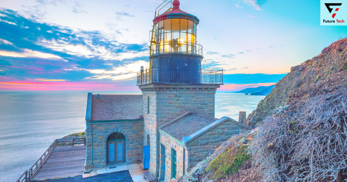
16. Lighthouse at Point Sur
This historic landmark is the sole public lighthouse in California from the turn of the century. Situated atop Point Sur lies the lighthouse, with a view of the roaring seas below. Wednesday through Saturday, tours of the lighthouse are available for $15. On a moonlight tour, you can also see the claims it is a haunted lighthouse.
17. Beach Pfeiffer
This beach is well-liked by the residents and well-known for its purple sand, created by manganese garnet particles. You can explore the tide pools and Keyhole Rock, a natural arch, for the $10 state beach access charge.
In this section of Big Sur, the roadway curves inward, so be careful not to miss the right onto Sycamore Canyon Road, which leads to Pfeiffer Beach.
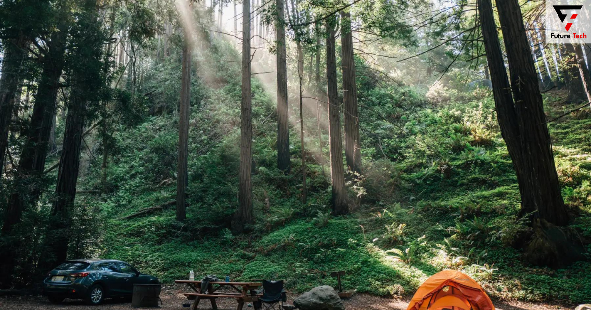
18. The Burns State Park at Julia Pfeiffer
For hiking and camping, Julia Pfeiffer Burns State Park is one of the most well-liked sites in Big Sur. One of only seven waterfalls in North America that empties into the ocean, the well-known McWay Falls is seen from a highway overlook.
Additionally, think about making a stop to hike some of the most well-liked trails nearby:
The 4.5-mile Ewoldsen Trail winds through an old redwood growth gorge steeply.
A strenuous 1-mile loop walk in Partington Cove leads through a 60-foot tunnel to observe tide pools along the shore. Landslides have harmed specific trails, so before you hike, find out how the tracks are doing.
19. The Big Sur Bakery and Nepenthe
The same family has owned and run this well-liked lunch place with an ocean view since it opened its doors in 1949. After dinner, indulge in some well-known ambrosia burgers and cookies from Big Sur Bakery.
20. Limekiln State Park
A favorite spot for quiet beaches and scenic vistas, Limekiln State Park is ideal for a leg break. Four ancient kilns then used to extract limestone from the region in the late 1890s are the source of the park’s name.
Visit the 1.4-mile Limekiln Creek Falls Trail for a stroll that offers views of the well-known cascade and historic redwoods.
Frequently Asked Questions Regarding This Road Trip From San Francisco to Big Sur
How many days in Big Sur are necessary?
Even while you may explore the main attractions of Big Sur in a single day, stay there for at least two. It will enable you to stay longer and take in more local sights.
When driving through Big Sur, where should I stay?
When driving Big Sur, nearby Carmel or Monterrey are the ideal places to stay. For visitors planning day visits to Big Sur, these larger cities have plenty of lodging options, including motels, hotels, and rental houses.
Between Los Angeles and San Francisco, is Big Sur?
The Big Sur region lies roughly midway between San Francisco and Los Angeles. This part of Central California is home to the renowned Pacific Coast Highway and a rocky beach.
How long does it take to get from San Francisco to Los Angeles using the Pacific Coast Highway?
It takes roughly ten to twelve nonstop hours to journey via the route from Los Angeles to San Francisco, the Pacific Coast Highway. Most tourists drive from San Francisco to Los Angeles for two or three days.
In Big Sur, is driving safe?
Driving through Big Sur on the narrow, twisting Pacific Coast Highway carries some risks, but it is safe if you go slowly and don’t speed.
Is the drive to Big Sur worth it?
The drive is well worth it for Big Sur! There’s much to do, including breathtaking coast views, picturesque mountain climbs, and top-notch restaurants in outlying places. Everybody should put this road trip on their bucket list!
Is the Big Sur drive frightening?
The drive to Big Sur might be frightening for many who fear heights. The beautiful industry follows the cliff’s edge in certain places. Nevertheless, you may stay safe if you drive carefully and pull over at intersections.
Closing Remarks on the Big Sur to San Francisco Road Trip
This book highlights all the breathtaking locations from San Francisco to Big Sur via the Pacific Coast Highway. Even though the straight-through trip takes four hours, I advise taking two days and staying overnight in Monterey.
Keep the coastline and turnouts on your right as you drive the road from north to south. Ahead of this picturesque drive, remember to download Google Maps and all of your sites of interest.


